Languages
The Sustainable Development Reserve (RDS) - Rio Negro.
Tim Vincent 10/07/2025
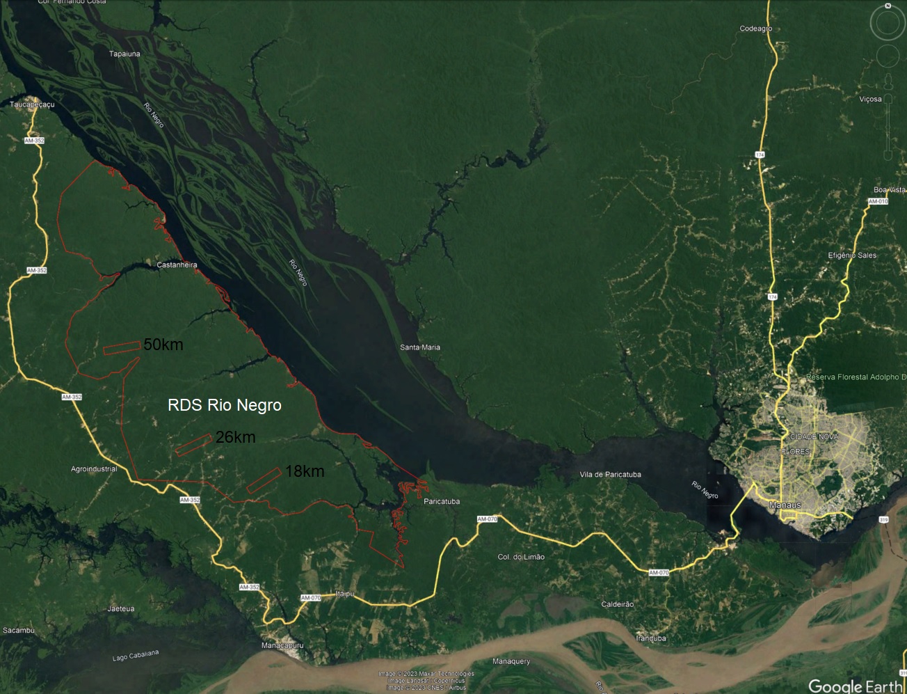
The Sustainable Development Reserve (RDS) of the Rio Negro was created in 2008 by law 3,355 and has a total area of 103,086 ha. The RDS of the Rio Negro is located in the state of Amazonas and encompasses the municipalities of Manacapuru, Iranduba, and Novo Airão. Access to the RDS of the Rio Negro is by river via the Rio Negro, departing from Novo Airão or Manaus (CEUC; ARPA, 2013). The section Manaus – Novo Airão can be accessed via the paved road AM-070, section Manaus-Manacapuru, and AM-352, section Manacapuru-Novo Airão, known as the Manairão Road.
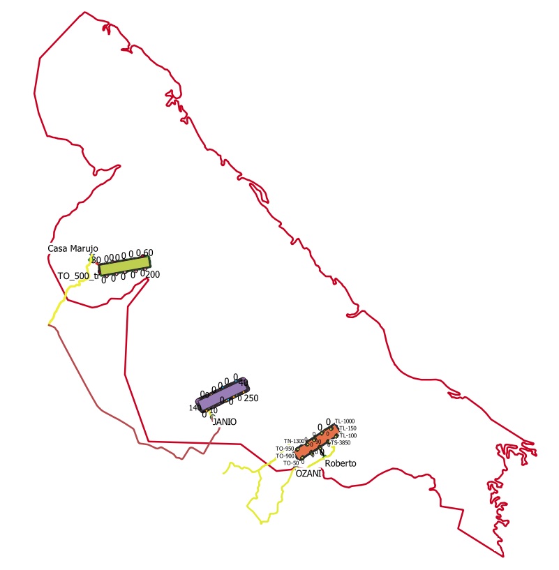
The first area where a RAPELD module was installed was located at km 26 of AM-352 (Uga-Uga road) at coordinates W 60 44’ 27.2”; S 3 04’ 14.5”.
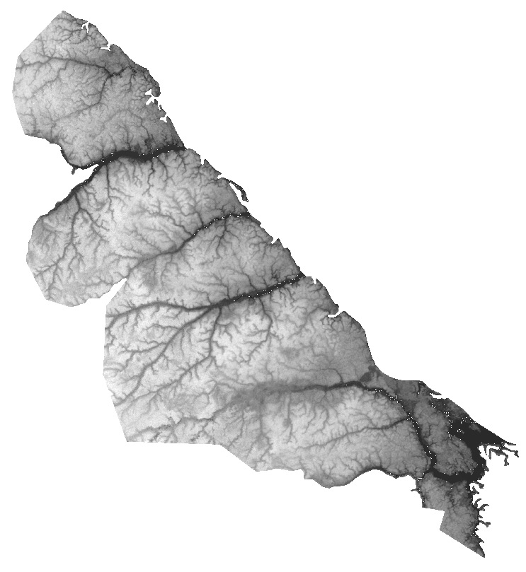
The environment is entirely composed of Dense Ombrophilous Forest. Biologically, it may include the possible presence of endemic species in vulnerable situations and new species; presence of vegetation formations of high conservation importance; heterogeneity of environments; a large number of springs of water bodies; lakes, beaches, streams, igapós, endemic fauna and flora of the Negro/Solimões interfluvium, and high potential for ecological tourism, especially community-based tourism and ornithological tourism (CEUC; ARPA, 2013).
(Adapted from https://uc.socioambiental.org/uc/5522)
CEUC; ARPA. Terms of Reference for hiring consulting services for the preparation of biological studies, physical environment, socioeconomic potential, tourism potential, and consolidation of Volumes I and II of the management plan for the Sustainable Development Reserve of the Rio Negro. Novo Airão, August 28, 2013.
Click the left image to download the Geopackage. Direct link to download elevation.
The Geopackage contains all the necessary information to create the associated map.
It can be opened in QGIS or by right-clicking and opening with the QGIS application.

Click on the images to enlarge
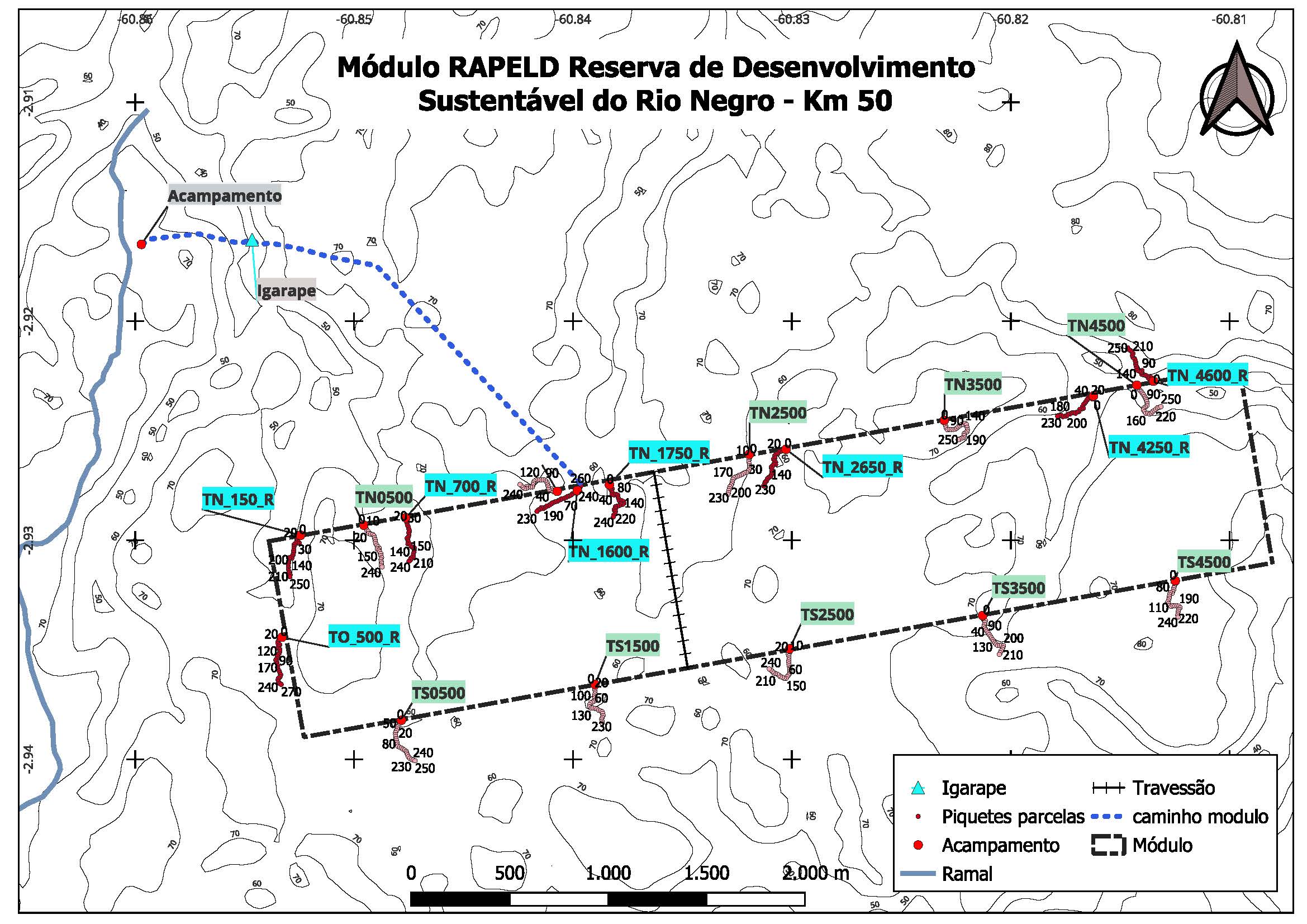
| KM18 | KM26 | KM50 |
 |
 |
 |
Photos taken in the RDS Rio Negro
