Languages
Installing a RAPELD grid or module.
Implementing a RAPELD site (Get the PDF here) is simple and relatively inexpensive considering the economy of resources created for integrated research. After the location of the grid or module has been determined, the installation process can be carried out by a surveying company or by your own team of researchers. The installation is generally carried out by a team of 5 or more people.
Before start opening the trails it is necessary to georeference the area of interest. We recommend the demarcation of three points using a geodesic or differential GPS that are used for triangulating starting points and taking initial bearings and should be idenitified by standard cement landmarks (INCRA model - Figure 1).
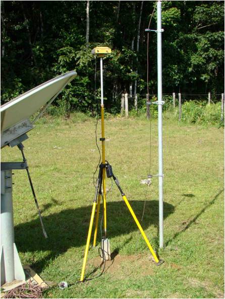
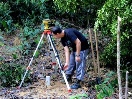
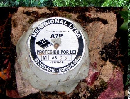
Figure 1. Geodesic equipment in ESEC Cuniã - RO. Marck instalation in LBA/INPA - ZF2 Research Base - Manaus and the cement landmarks INCRA model.
We recommend protecting these markers with a fence of 1x1m, 1m in height. Usually we put one of these landmarks near the headquarters of the protected area and the other two near the grid or module to make it easier for the surveyor.
The trails should be straight, except when you need to dodge a tree, and be 1m wide. No plant, tree or vine, more than 10cm in diameter may be cut. However, all other plants, smaller than 10cm in diameter, should be cut as close to the ground as possible so that people don't trip over them. The team is expected to survey the altitude and GPS location every 50 m along the trail. At each of these points there should be a PVC picket with an aluminium tag to identify the trail and the distance along the trail (figures 2 and 3).
After opening the trails for the grid or module, the permamnent, uniformly distributed plots are installed. Get the PDF.
MATERIALS
- GPS
- Compass
- 50m measuring tape.
- Machete
- File
- ½ “ PVC tubing. 1m lengths.
- Saw - Aluminium labeling tags.
- Telephone wire
- Set of Alpha-numeric stamps.
- Hammer
Material and Equipment Recommended:
Workstation equipment with geo-processing programs, database and spreadsheet;
reception apparatus for high-precision GPS signal (geodesic) - only to track the initial milestones;
total station or theodolite and accessories;
compasses;
measuring tapes;
PVC ¾ diameter tubes (cut into pieces 1 m high) for marking the tracks, with the top painted red. For each track will take 100 pieces and therefore to the set of tracks will take 1,200 pieces;
½ PVC pipes inch diameter (cut into pieces of 50 cm) for marking the plots. For each installment will take 30 pieces of 50 cm, so to the total number of shares will be required 900 pieces;
Aluminum coil for making the plates for marking films in PVC pipes;
Game alpha-numeric marker (to make the entry in the pipes aluminum plates).
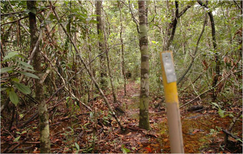
Figure 2. Trail on a RAPELD grid in Viruá National Park, Caracaraí - RR, picket the L3-750.
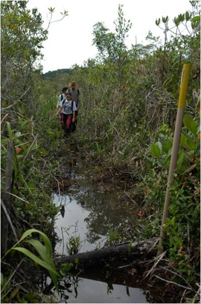
Figure 3. Viruá National Park in N1-2650 track.
PPBio Portal was developed by the management team of Data Repository PPBio/CENBAM · Copyright © 2012 · All rights reserved
2.936 André Araújo AVE - Petrópolis - Zip Code 69060-001 - Manaus-AM-Brasil
Post Box: 2223
