Languages
PARNA Viruá (National Park)
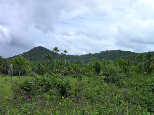
The Viruá National Park has more than 227,000 ha and is located in the municipality of Caracaraí (RR). The climate is equatorial (hot and humid), presenting a small dry season, with larger pluviometric falls in autumn. In the South part, the area comprises a vast surface almost flat, with predominance of sandy and poorly drained soils, with great amount of lagoons. In its northern part, there are residual hills with modest altitudes. Along the western extension, delimited by the Rio Branco, there is occurrence of alluvial floodplains, a situation also observed in the southern portion, along the Anauá River.
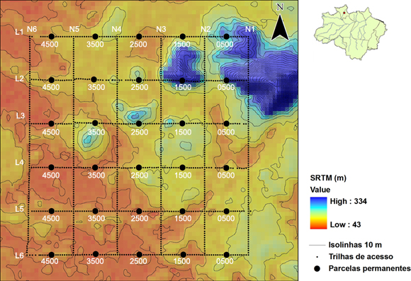
The installation of the track grid in the Parna of Viruá was conceived by the members of the Regional Hub PPBio Roraima and completed in March of 2006, its sampling site is a standard RAPELD grid (25 km2). Data obtained in this way are the most complete and most useful for monitoring long-term and geographical comparisons. We suggest that grid monitoring studies use the methods described in data metrics from previous PPBio studies, or include a calibration phase within the project to ensure that data can be compared (Read more on the PPBio Portal).
Metadata
Guidelines to facilitate a search in the repository: on the search page of the link above, type a keyword: Viruá
Other information
Check out the Multi-Annual Report (2005 - 2008) of the PARNA Viruá Research and Monitoring Program.
Contact
Antonio Lisboa
Tel - (95) 3623-9513
PPBio Portal was developed by the management team of Data Repository PPBio/CENBAM · Copyright © 2012 · All rights reserved
2.936 André Araújo AVE - Petrópolis - Zip Code 69060-001 - Manaus-AM-Brasil
Post Box: 2223
