Languages
Infrastruture - Parque Estadual do Cristalino Module
The Cristalino State Park (Parque Estadual do Cristalino) is located in the municipalities of Alta Floresta and Novo Mundo, in the extreme north of Mato Grosso, between the Teles Pires River and the border with Pará. Most of its area is located in the municipality of Novo Mundo, the westernmost portion of the Park is in the municipality of Alta Floresta. To the north, it borders the Brazilian Air Force Base, in the State of Pará, which houses an extensive area of native vegetation. Its other limits to the west, east and south border with rural properties.
The Park has about 184,900.00 hectares and was created in 2001 with the objective of preserving animals and species of native trees threatened with extinction. The existing plant types are ombrophilous forest, seasonal forest, campinarana, rupestrian field in the Amazon, pioneer formations with fluvial and / or lake influence.
For the works in the PPBio module, we used the area provided by the SEMA (State Secretariat for the Environment) farm.
Access
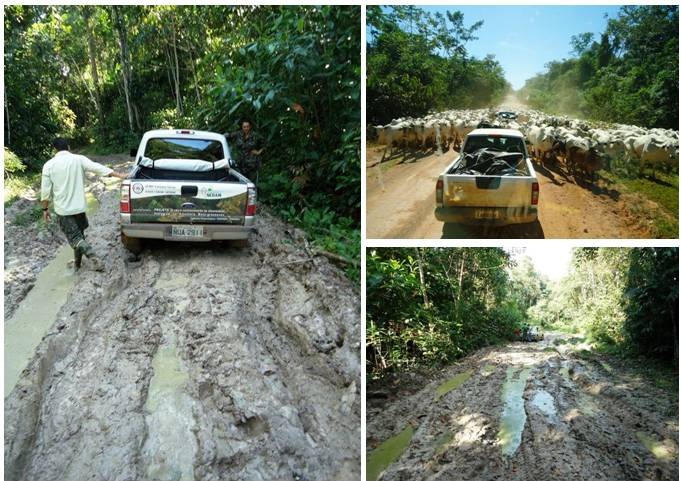
There are two main means of access to the Cristalino State Park: by land and river.
By land, the main access is by the Quatro Leste road, a side road with gravel pavement (laterite), which connects the park to the headquarters of Alta Floresta. The crossing of the Teles Pires River is done by ferry. The East Fourth enters the interior of the park, up to the banks of the Cristalino River. There is also a dirt road that departs from the Primeira Leste Highway and runs parallel to the boundary between the states of Mato Grosso and Pará. From this road, an access that crosses the state boundary and reaches the banks of the Cristalino River was opened. This access is controlled by local farms. In addition to these, there are unofficial roads, opened by farmers and loggers, that penetrate the far east of the Park, but do not reach the Cristalino basin.
By river, access is provided from the Teles Pires River, where there are several favorable places for launching small boats, up to the mouth of the Cristalino River. The Cristalino River runs through the Park and is navigable along its entire length, despite the large number of submerged rocks and small rapids along its course.
There is also an airstrip for small aircraft on the farm.
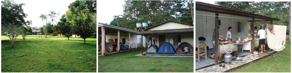
Accommodation
To house researchers and students, the SEMA farm offers a house with four bedrooms, a bathroom and a power generator.
Camp
To camp the researchers and students use the veranda and areas close to the house provided by SEMA as accommodation.
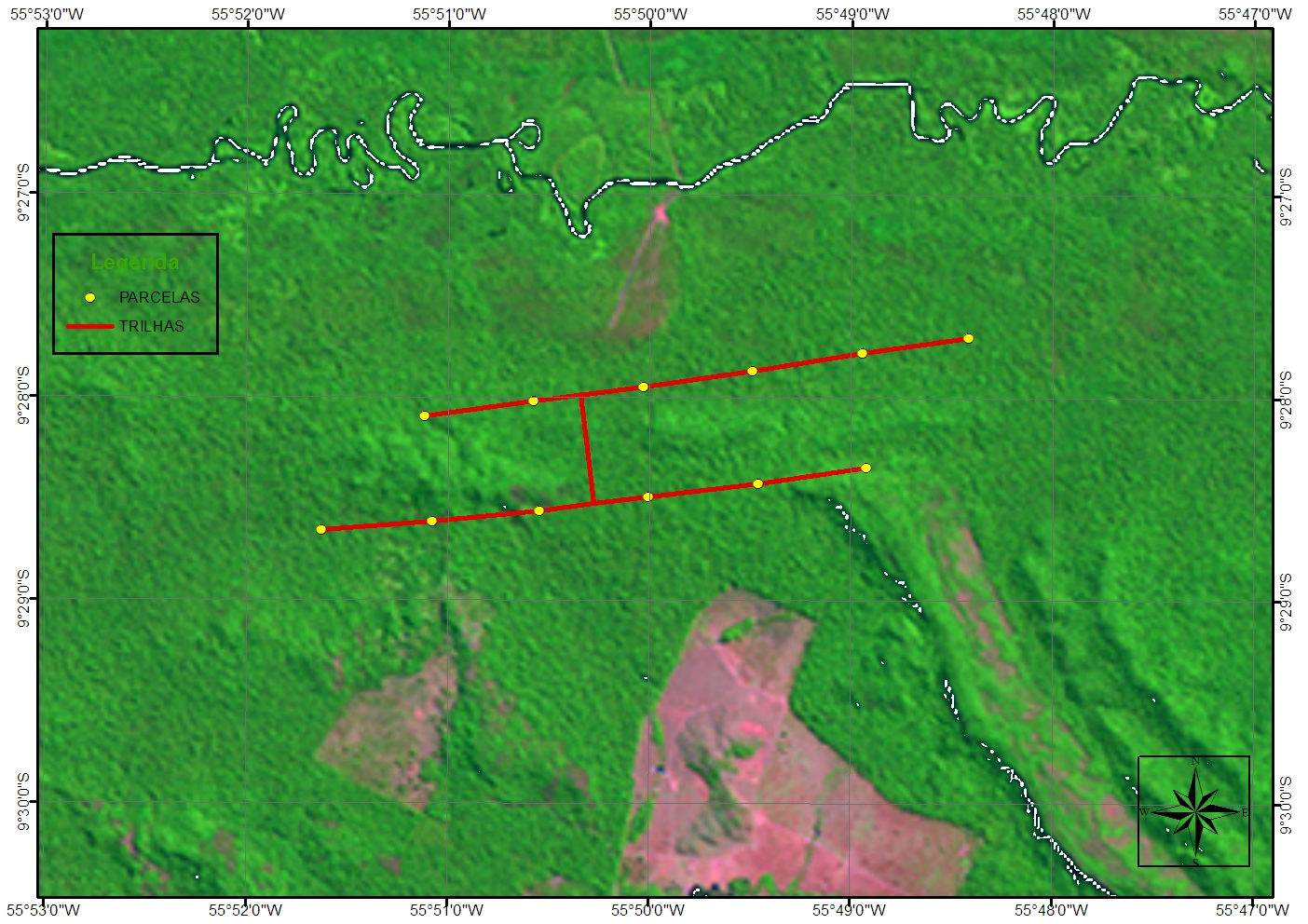
Plots
The module consists of two trails spaced 1 km apart, forming a rectangle of 5 km². A permanent plot of 250 m was installed at each kilometer of this system, resulting in 12 land parcels.
Access infrastructures in the field
Access in the field to the parcels of the module is made by two roads that cut the module longitudinally, the first and main one of which is accessed through parcels 2 and 3 and crosses parcel 8 and the second accesses parcels 11 and 12. The relatively flat relief facilitates locomotion within the farm, but traction cars are still needed.
Geographic coordinates
09 ° 25 ’09 ° 43’ S
55 ° 09 ’56 ° 02’ W
Transport
Ford Ranger
L200
Motor flywheel
Detail image of the Cristalino State Park module.
Contact
Prof. Dr. Domingos de Jesus Rodrigues
PPBio Portal was developed by the management team of Data Repository PPBio/CENBAM · Copyright © 2012 · All rights reserved
2.936 André Araújo AVE - Petrópolis - Zip Code 69060-001 - Manaus-AM-Brasil
Post Box: 2223
