Languages
Infrastruture KM 260 Module
Access
The M05 module is located about 260 km from Manaus, on the right side of the track (towards Humaitá). It is the first module departing from Manaus in which it travels over a bad stretch of road where there are many holes and the speed of the trip will drop to 20 or 30 km per hour. In the rainy season (November to May), care should be taken as there are some sections with a lot of mud, in addition to the holes, and a 4x4 vehicle equipped with flat tires is essential (a car equipped with a winch is also desirable for this stretch). Departing from Manaus, the ferry crossing from CEASA (R $ 35.00) takes place to the municipality of Careiro da Várzea. From Careiro da Várzea to the city of Careiro Castanho (better known as Castanho) are 100 km of asphalt in good condition. The city of Castanho is the last place where it is possible to get fuel, ice and food, buy some field material, make connections, etc. From there, there are another 75 km of road, mixing sections of good and bad conditions to Vila do Tupana. The next section, with about 80 km, connects Tupana to Igapó-açú (community that is after the M05) and is in very bad conditions with the well deteriorated asphalt and, really, many deep holes.
Conditions of the trails and camps
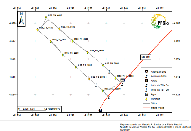
The camp (with capacity for 15 people) is about 160 meters on the right side of the road (towards Humaitá) taking the same trail that gives access to the northern trail (TN), however the camp is deteriorated and unable to house teams of field. The tarps of the camp were stolen and the wooden structure was exposed to the weather, which caused the degradation of the site.
TN's entrance is easy to find, it is between a wooden bridge on BR319 and Dona Tereza's house, on the right side of the road. TN is in good condition and the plots are marked with pickets and demarcation tapes. The southern trail (TS) has a less used entrance and therefore more difficult to locate from the road. It is possible to access the TS from a trail that leaves the TN about 200 meters from the camp. Therefore, it is not necessary to take the road to access the beginning and the first installment of the TS. There is a second connection path between TN and TS that is at the bottom of the module. This trail is standard on all modules and can be seen on the area map. Always load the GPS before traveling with the coordinates of the entrances of the trails, camps and parcels!
What's nearby
The reference for those who are on the M05 is the Igapó-Açú community and the Embratel Gilberto Araújo tower. For those leaving Manaus in the direction of Humaitá, the M05 is approximately 6 km before the Gilberto Araújo tower and 12 km before the Igapó-Açu community. A few meters after the entrance of TN is the home of Dona Tereza and Seu Zé da Coroa, the closest residents of the M05. Dona Tereza usually cooks for the research teams. She knows all the staff at Igapó-Açú and can indicate where to get things if it is necessary to go to the community.
Where to get water
In the M05 there is a well with a wooden box dug to the right side of the camp. Well water should be treated with hypochlorite, or something similar, whenever used for drinking or cooking. It is recommended to take chlorine to play directly in the well as it is left unused for long periods and there may be proliferation of insects. If you are going to use the well water to bathe, remember to do this away from the well box to avoid water contamination. Also, keep the well closed. There is also a lake next to the camp that can be used for bathing and also to get water to drink. This water is usually lighter than the well and looks cleaner. Even so, treatment before drinking is recommended.
Local staff
If you are going to need someone for a field assistant at M05, there is a possibility to hire Seu Zé da Coroa (who lives between TN and TS), but it is not certain that he will be there or available to do the job at desired period. Therefore, it is recommended to take your field assistant (s) from wherever you are leaving or even from Castanho. However, Dona Tereza, wife of Mr. Zé, is normally looking after the house and is available to cook at the camp and take care of things while the team is working on the trails.
Safety
BR-319 is commonly used as a route by different walkers, which can be malicious. Therefore, in all modules it is recommended to have someone who takes care of belongings in the camp during the days of working on the trails (a cook for example). In the M05 it is necessary to have at least one motorcycle that will remain in the camp during the tour period, since there is a certain flow of vehicles to Igapó-Açú. This support vehicle is essential in case of an emergency.
If you need help
If it is necessary to go in search of food or use the phone, the options are the Igapó-Açu community and the nearest Embratel tower. At Embratel's tower (6 km in front of the module towards Humaitá), if there are any employees, it is possible to have access to a telephone for external calls or a radio for communication between towers. In the Igapó-Açu community (12 km ahead towards Humaitá) it is possible to buy basic food (rice, beans, flour, sugar, coffee and fish), there is a public telephone (which does not always work) but there is nowhere to buy phone card. Groceries are sold before and after crossing the Igapó-Açu river. The pay phone is after the crossing. On the other side, on the left bank, there is a restaurant and two options for staying overnight: one is the straw hat of the community that is next to the pay phone and can be used free of charge; the other option is the accommodation of Seu Raimundo, which is next to the restaurant (a green house just above the ferry landing). If using the straw hat, the use of mosquito nets is recommended, as there are many cases of malaria in the Igapó-Açu community.
Term of commitment and rules of conduct
Before going to the field, you must download, read and sign the Term of Commitment and Standards of Conduct of BR-319 and send it to the PPBio Management at email gerencia.ppbio@gmail.com.
Download the official GIS with all points along BR-319: Shapefiles Modules BR-319
Contact
Gerência PPBio
Coordenação de Pesquisas em Ecologia
Instituto Nacional de Pesquisas da Amazônia
PPBio Portal was developed by the management team of Data Repository PPBio/CENBAM · Copyright © 2012 · All rights reserved
2.936 André Araújo AVE - Petrópolis - Zip Code 69060-001 - Manaus-AM-Brasil
Post Box: 2223
