Languages
Flona do Amapá
The Amapá National Forest covers an area of 459,867 hectares and is located in the the Guiana Shield region, in the center of the State of Amapá and covers part of the three municipalities of Ferreira Gomes, Pracuúba and Amapá. This conservation unit was created in 1989 to enable the sustainable exploitation of wood, as well as to protect the biodiversity and the continuity of low impact activities carried out by indigenous populations that already inhabited the area. However, the isolation of the unit has contributed to the fact that logging has not yet started. The FLONA (FLOresta NAtional) of Amapá is surrounded by two other large conservation units, bordering to the east with the State Forest of Amapá and to the west with the National Park of the Tumucumaque Mountains. These units are part of the Amapá Biodiversity Corridor, a grouping of protected areas that total more than 70% of the total area of the State.
The climate is tropical and humid with temperatures ranging between 22 º C and 32 º C and an annual average rainfall of 2,284 mm with a drought season between August and September where it rarely rains less than 60 mm monthly. The relief is dissected by bodies of water with altitudes between 160 and 200 m and plateaus of up to 460 m in the south of the unit. A red-yellow argisol predominates in the area. The dense terra firme ombrophilous forests occupy 97% of the unit. The understorey is dense with few palm trees, but in lowland areas there are large groups of açaí (Euterpe oleracea). The canopy is closed, ranging from 30 to 40 m, with emergent species (e.g. Dinizia excelsa) reaching up to 50 m.
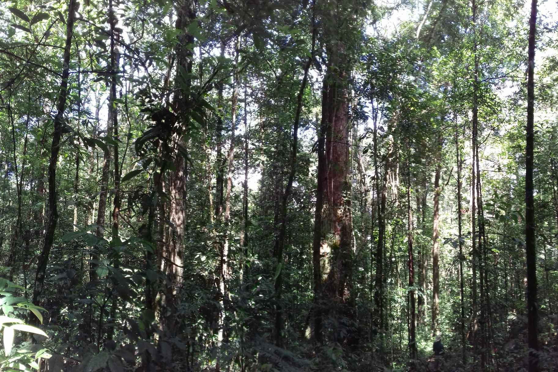
An understory view of the "terra firme" or upland forest in the FLONA do Amapá. Photo: José Júlio Toledo.
Preliminary surveys of various plant and animal groups have already demonstrated the region's high biodiversity. Inventories carried out in some plots showed more than 200 tree species per hectare. In addition, rapid surveys carried out for the management plan of the unit, have recorded 39 species of medium and large mammals and 180 species of birds.
A grid of trails following the PPGBio (The Tropical Biodiversity Graduate Program) model, which consists of 6 North-South and 6 East-West trails of 5km (25 km2) in dense terra firme ombrophilous forest, was installed in 2008 at the southern end Of FLONA of Amapá. The system of trails and permanent plots is already used in studies on structure, biomass and tree diversity, on the distribution of plant species of commercial interest (eg Carapa guianensis), medium and large mammals, epiphytes, fruit production, phenology and frugivory . A master's and a doctoral dissertation have been completed and 5 master's dissertations are currently underway.

Metadata.
TO SEE THE METADATA AND DATA RELATED TO THIS SITE, GO TO THE PPBIO DATA REPOSITORY
To find the information just enter the keywords: Flona Amapá
Contact:
