Languages
BR-319 Modules 12, 13 - Infrastructure
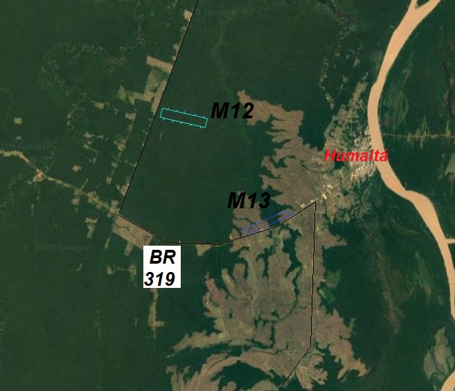
These last two modules are in Army areas (# 12: lat. -7,534, long. -63,244; # 13: lat. - 7,521, long. -63,109), a cooperation that has existed since 2011. Detailed weather data on these modules has been obtained from LBA towers, but these towers are currently disabled. These areas are close to Humaitá and represent phytophysiognomies (continuous forest and the interface between gallery forest and Amazonian savannah) that have already been eliminated in other places in this region .

Maps (PDF)
Shapefiles (ZIP)

